Map
Click on a flagged location for photos and detailed description :
Bottisham Lock /Clayhithe /Baits Bite Lock /Jesus Lock /The Mill Pond /
The Halingway and 48 Hour Moorings /
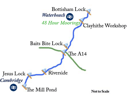
This map is to give you a guide to the above locations and is not to scale. For all up to date train times visit www.nationalrail.co.uk
Visit Sustrans cycleway - National Cycle Network Route 51 (Cambridge to Bottisham)
The navigation authority for the River Cam since 1702.